
One hundred and one miles of dirt between two wilderness areas, and a long argument with the idea that a burned forest is a ruined one.
The best sign on the Magruder Corridor is not the official one.
The official one is a yellow diamond up a pole at the edge of Elk City, Idaho: RECREATIONAL XINGS, 500 FT. It is doing its best. It went through a process. Somebody specified the reflective sheeting.
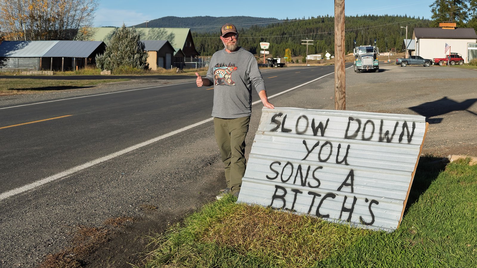
Leaned against the post underneath it is a sheet of corrugated roofing with six words on it, applied by someone who did not go through a process:
SLOW DOWN YOU SONS A BITCH’S
The apostrophe is indefensible. The message is not. Somebody here watched enough trucks come through at fifty to conclude that the committee version wasn’t landing, and they were correct. Read it twice — because we came at the Magruder backwards, east to west out of Montana, and this was the first hand-lettered word from another human being in a hundred miles.
A road that only exists because a line had to go somewhere
The Magruder Road runs 101 miles between Red River, Idaho and Darby, Montana. We ran it east to west, climbing in from the Bitterroot to Nez Perce Pass on the Montana line and dropping the length of it into Idaho — the reverse of the way most people and most guidebooks go. Single lane, mostly dirt, cut by the Civilian Conservation Corps in the 1930s and — in every way that matters to your suspension — not meaningfully improved since. Budget six to eight hours. You will average twelve to fifteen miles an hour, and you will stop more than you meant to.
Here is the part that earns the shocks.
For its entire length, the road is a seam between two wilderness areas. The Selway-Bitterroot to the north: 1.2 million acres. The Frank Church–River of No Return to the south: 2.3 million. Three and a half million acres of designated wilderness, and one thin scratch of dirt running down the middle of it, left out on purpose when the boundaries were drawn.
So you are not driving through wilderness. You are driving along the only line in it that isn’t.
That reframe is most of the trip. Every time you stop and get out, everything you can see in both directions is permanently off the table. No roads coming. No development coming. The strip of gravel under your boots is the exception, and it is only there because a line had to go somewhere and this is where they put it.
Which brings us back to Elk City, because that is where Lloyd Magruder started too.
Magruder was a Lewiston merchant. In the summer of 1863 he took a pack string east out of Elk City on the South Nez Perce Trail — more or less the route under your tires — and sold his goods to the miners at Virginia City at a serious profit. He started home in October carrying something like thirty thousand dollars in gold dust and twenty thousand in coin, which he had been unwise enough to mention.
Four men attached themselves to his party on the way out. On the night of October 11 they killed Magruder and four of his companions, rolled the bodies off a cliff somewhere around mile 44, and ran for San Francisco with the gold. They very nearly got away with it. What undid them was Magruder’s friend Hill Beachey, who chased them the length of the coast, brought them back, and saw them tried in Lewiston. They were hanged the following year — the first legal execution in Idaho Territory.
So the road is named for the man who was killed on it rather than the men who did it, which is at least the right instinct. And we were driving it backwards from the way he did — west, toward the town he set out from and never made it home to. Retracing a dead man’s route in reverse is the sort of thing that sits with you around mile 44.
The burn is not the damage. The burn is the subject.
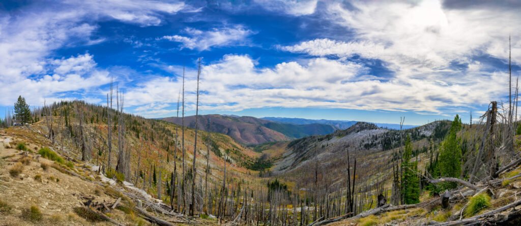
Most people drive into country like this and reach straight for destroyed. Devastated. Moonscape. They photograph the gray trees, feel appropriately sad about it, and keep driving.
The gray trees are the least interesting thing out there.
Most of what you are looking at here is the Gold Pan Fire. Lightning started it in mid-July of 2013, it ran to something like fourteen thousand acres, and at one point it crossed this road and shut about twenty miles of the corridor between Nez Perce Pass and Observation Pass. It burned right up to the doorstep of the old Magruder Ranger Station and then declined to take it.
That date matters more than it sounds like it does, because a burn is not one thing. It is a sequence, and knowing where you are in the sequence is the whole trick.
If you had stood here in 2015 this would have been a different place entirely. Beetles in the standing dead, and Black-backed Woodpeckers working them over — a bird that is close to a burn specialist, showing up within a year or two of a fire, feeding hard while the beetles are thick, then leaving. A green forest is, for that particular woodpecker, a food desert. Their window in any given burn is roughly the first half-decade.
That window closed here years ago. What you get instead, more than a decade on, is the next chapter: snags that have started coming down on their own, shrubs and young conifers well past the point of being a novelty, and enough autumn color running up the slopes to make the whole hillside read orange and rust from a mile away. The color is not decoration. It is a shrub field having the best years of its life in a window with no canopy over it — a window that is already closing as the conifers come up underneath.
Come back in thirty years and this is closed canopy again, and the only evidence will be a few silvered logs on the ground and a suspicious uniformity in the age of the trees.
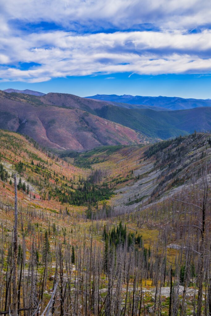
Now ask the question that makes the whole view snap into focus: why did it burn there and not there?
Because it did not burn evenly. It never does. Look at the bottom of the drainage and there is a green ribbon of survivors — wetter, shaded, sheltered, cool enough at the moment the fire came through. Look at the aspects: the slope that faces the afternoon sun is drier, thinner, and it got hit differently from the one across the valley. What you are reading is a mosaic, and the mosaic is the point. That patchwork of burned, half-burned, and untouched is the single best predictor of what this drainage will look like in fifty years — where the seed comes from, where the elk winter, where the next fire slows down.
Fire is not an interruption of this landscape. It is one of the main things the landscape does. Out here it happens most years, somewhere. The interesting question was never whether it burned. It is how, and where it didn’t.
The rock is older than the argument
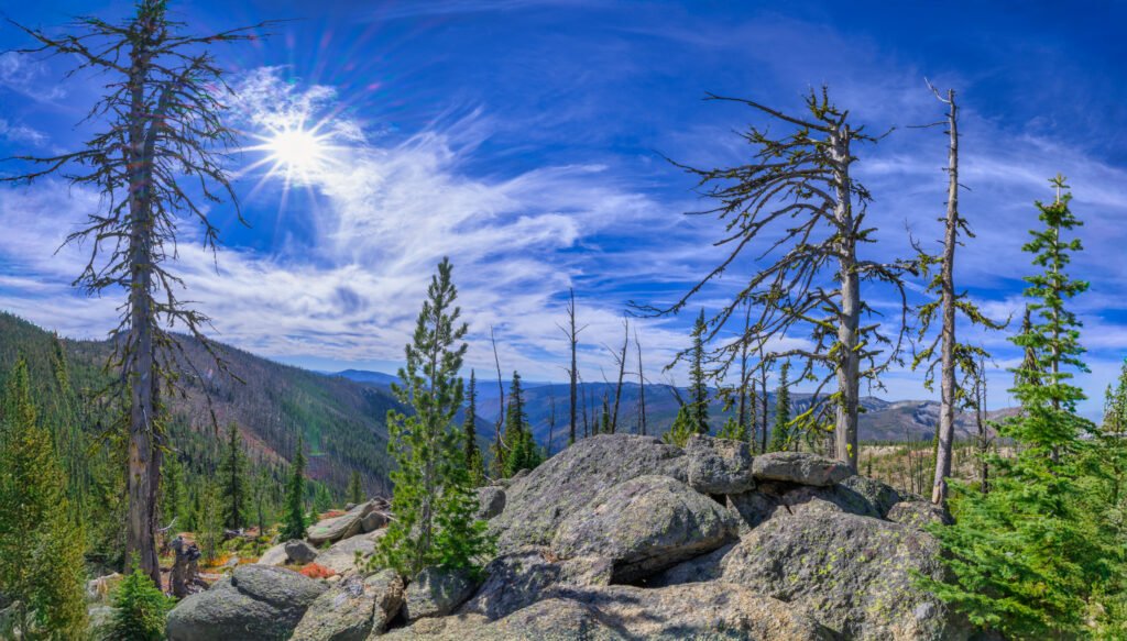
Get out on the ridge and put your hand on one of these boulders. You can see the individual crystals without a lens — quartz, feldspar, flecks of dark mica. That grain size is not cosmetic. Crystals get big when magma cools slowly, and magma cools slowly when it is buried under miles of rock. This is granite from the Idaho Batholith, and it solidified somewhere in the neighborhood of 85 to 65 million years ago, a long way underground.
You are now standing on it at nearly 7,900 feet. Everything that used to be on top of it is gone — eroded off over tens of millions of years, with the whole block floating up as the load came off. The rock did not climb. The lid came off.
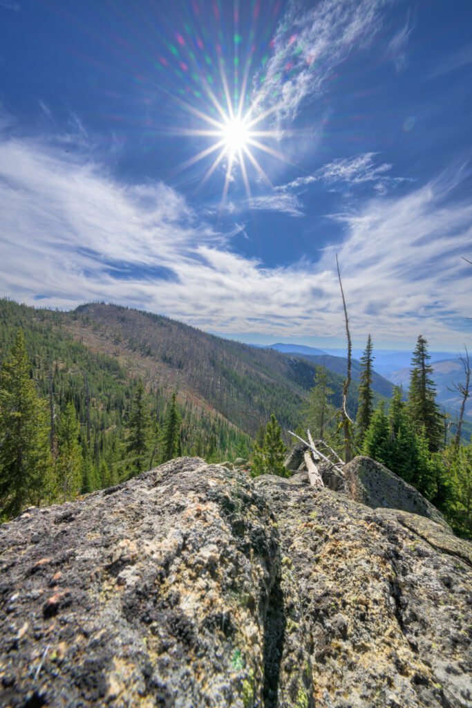
Then there is the practical half of that story, which you have been driving on all day. Granite weathers badly. Feldspar breaks down, the crystals let go of one another, and the rock crumbles into coarse gravel — grus, if you want the word for it. That is your road surface. That is also why the cutbanks look the way they do and why the soil is thin and gritty enough to hear under your boots.
It is also why this country moves. In August of 2014 — one year after Gold Pan — a hard rain landed on the burn and sent mud and rock across the road, closing it. Nothing about that is a coincidence. Fire takes the roots and the duff off a slope, the slope is made of half-rotted granite to begin with, and the first serious storm collects the bill.
The geology, the fire, and the condition of the road are not three separate subjects. They are one story, and you are experiencing it at twelve miles an hour.
The sign was right
You cannot do this road fast. The surface will not let you, and neither will the country. Twelve miles an hour turns out to be roughly the speed at which you start noticing the mosaic in the burn, the crystals in the rock, and the green ribbon down in the draw that tells you where the fire ran out of enthusiasm.
Which is more or less what the guy with the spray can was getting at, though I suspect he was mostly thinking about the dogs.
Practical notes: high clearance, real spare, no services and no reliable signal for the full 101 miles. Snow closes it — the season is short, roughly midsummer into early autumn. Check current conditions with the Nez Perce-Clearwater and Bitterroot National Forests before you commit, because a slide can close it with no warning and the detour is measured in hours.